Log In/Sign Up
Your email has been sent.

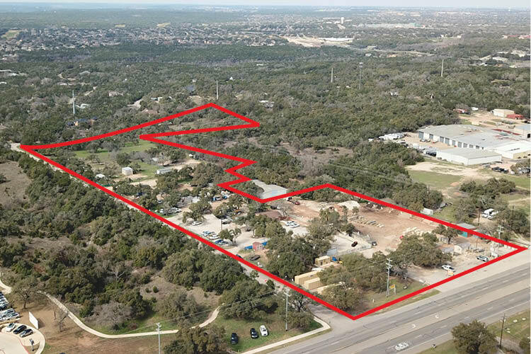
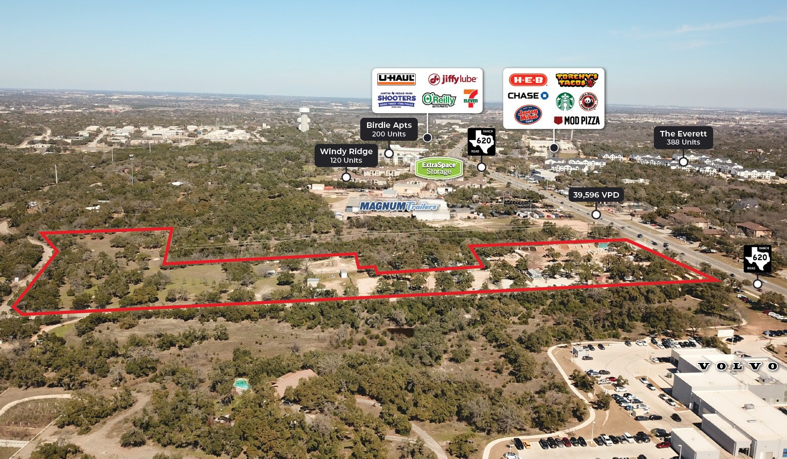
11812 Windy Ridge Rd - RR 620 and Windy Ridge 13.78 Acres of Commercial Land in Austin, TX 78726

INVESTMENT HIGHLIGHTS
- No Floodplain
- City of Austin Water and Waterwell
- Frontage: 350’ on RR 620 and 1,350’ on Windy Ridge
- No Future Land Use Map
- Zoning: GR-CO, RR
- Proposed Uses: Multifamily, Retail or Commercial
EXECUTIVE SUMMARY
The 13.78-acre site is located at the corner of RR 620 and Windy Ridge Road, featuring approximately 350 feet of frontage on RR 620 and 1,350 feet on Windy Ridge Road. The site is subject to zoning classifications GR-CO and RR, with zoning case C14-02-0154 and ordinances 050127-59 and 860109-C governing its use. It falls within the Hill Country Roadways Overlay (Moderate Intensity) and Scenic Roadways Overlay (RM 620). This is one of very few over 5 AC tracts available fronting on FM 620 for development between Anderson Mill and Mansfield Dam.
While there is no Future Land Use Map (FLUM) or Regulating Plan, the site is located within 1.5 miles of a Wildland Area per the Wildland Urban Interface classification. There are no designated infill options, neighborhood restricted parking areas, mobile food vendor zones, or historic landmarks.
From an environmental perspective, the site is not within a FEMA or fully developed floodplain but does fall within the Lake Travis Watershed and the Edwards Aquifer Recharge Zone (North). Water supply to the area is designated as rural.
Tenants are responsible for all utilities, maintenance, and insurance and receive free water from the existing property well. The landlord pays taxes.
For official zoning verification and development guidance, consultation with the Land Development Information Services or a Zoning Verification Letter is recommended.
PROPERTY FACTS
| Sale Type | Investment or Owner User | Property Subtype | Commercial |
| No. Lots | 1 | Proposed Use | Multifamily |
| Property Type | Land | Total Lot Size | 13.78 AC |
| Zoning | GR-CO, RR | ||
| Sale Type | Investment or Owner User |
| No. Lots | 1 |
| Property Type | Land |
| Property Subtype | Commercial |
| Proposed Use | Multifamily |
| Total Lot Size | 13.78 AC |
| Zoning | GR-CO, RR |
1 LOT AVAILABLE
Lot
| Lot Size | 13.78 AC |
| Lot Size | 13.78 AC |
The 13.78-acre site is located at the corner of RR 620 and Windy Ridge Road, featuring approximately 350 feet of frontage on RR 620 and 1,350 feet on Windy Ridge Road. Zoning: GR-CO and RR. Proposed Uses: Multifamily, Commercial or Retail


1 of 5
VIDEOS
MATTERPORT 3D EXTERIOR
MATTERPORT 3D TOUR
PHOTOS
STREET VIEW
STREET
MAP
Presented by
11812 Windy Ridge Rd - RR 620 and Windy Ridge
Already a member? Log In
Hmm, there seems to have been an error sending your message. Please try again.
Thanks! Your message was sent.