Your email has been sent.
12748 Gas Point Rd 20 Acres of Agricultural Land Offered at $94,972 CAD in Igo, CA 96047
Property Facts
| Price | $94,972 CAD | Property Type | Land |
| Sale Type | Investment | Property Subtype | Agricultural |
| No. Lots | 1 | Total Lot Size | 20.00 AC |
| Zoning | Rural | ||
| Price | $94,972 CAD |
| Sale Type | Investment |
| No. Lots | 1 |
| Property Type | Land |
| Property Subtype | Agricultural |
| Total Lot Size | 20.00 AC |
| Zoning | Rural |
1 Lot Available
Lot
| Price | $94,972 CAD | Lot Size | 20.00 AC |
| Price Per AC | $4,748.62 CAD |
| Price | $94,972 CAD |
| Price Per AC | $4,748.62 CAD |
| Lot Size | 20.00 AC |
Description
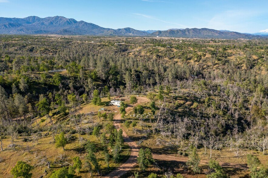
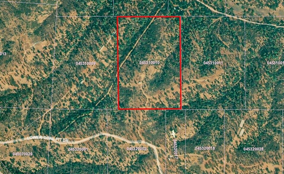
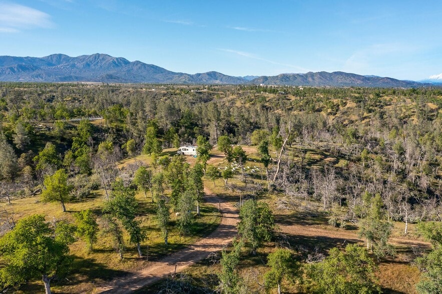
Level and rectangular ±871,200 SF (±20 Acres) of shovel ready land located within the Igo, CA community very close to I-5 between Centerville & Cottonwood. Property measures ±765' Wide By 1,138' Deep, is mostly level in a long elevated area with good soil, and is accessible via paved roads entering from Gas Point Rd & Dale Ln. Has an existing, permitted, operational well (from Shasta Drilling) completed in 2013 about 300’ north of Coal Pit Rd and 900’ off the Eastern parcel line (map/location available). Very close to Whiskeytown Lake, paved road access, long level area where former structures were present, electric nearby, and offers amazing views. Country property with spectacular views situated on top of a knoll. Beautiful breathtaking views looking over the area of Mount Shasta & surrounding Mountains that radiates peace & tranquility. The peaceful sound of nature, beautiful wildlife & privacy for miles. The zoning is very flexible and allows for a variety of residential, agricultural, and other uses; mobile home, trailer, manufactured or permeant construction. The property has quick access to both Highway’s I-5 & CA-299, which allows for convenient access to all the major highways in the area. Seller-Financing is available with only 10% down! Location Description This parcel is located 3 miles east of the Northern California Veterans Cemetery on Coal Pit Rd in Igo, CA. From Clear Creek Rd head onto Veterans Memorial Dr, keep left onto Gas Point Rd, then left onto Bradley Ridge Rd, then left onto Coal Pit Rd (gravel county road). Continue for 2,000' then keep right onto Lower Coal Pit Dr for 1 mile then stay right at the “Y” onto Bambow Rd; the destination will be on the left after 1,000’.
Property Taxes
| Parcel Number | 045-310-010-000 | Improvements Assessment | $0 CAD |
| Land Assessment | $74,565 CAD | Total Assessment | $74,565 CAD |
Property Taxes


Presented by

12748 Gas Point Rd

Hmm, there seems to have been an error sending your message. Please try again.
Thanks! Your message was sent.