Log In/Sign Up
Your email has been sent.

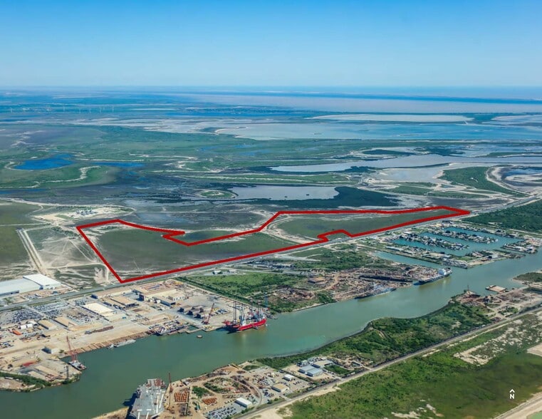
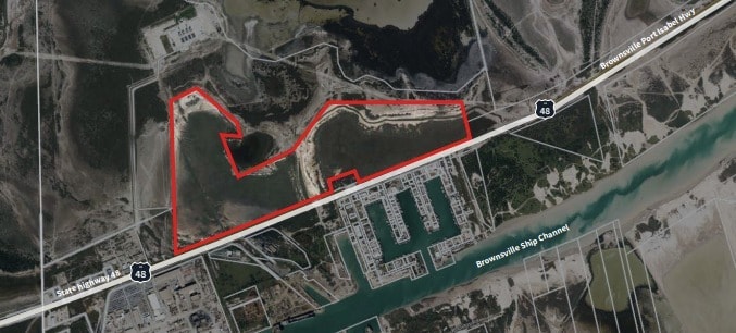
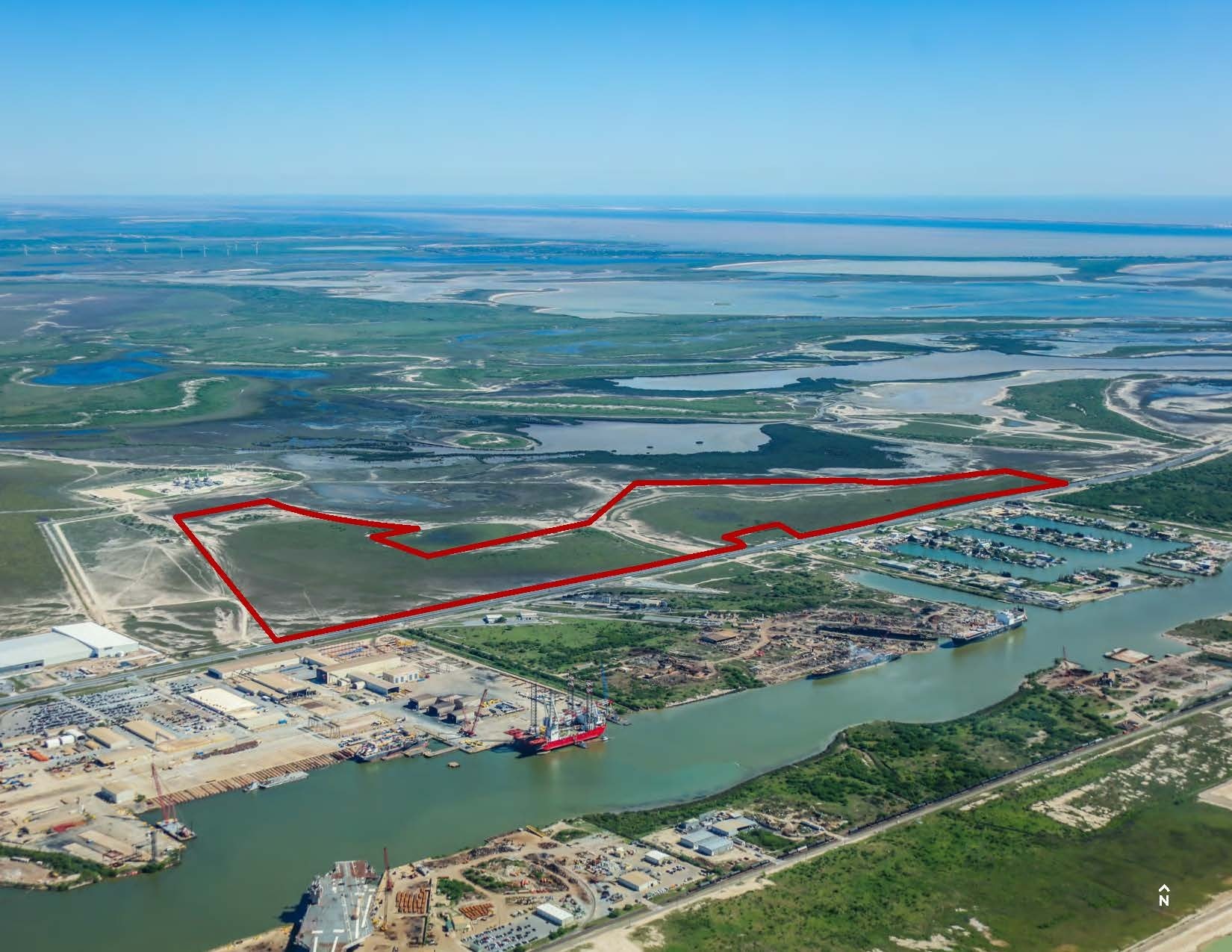
302.28 AC- Port of Brownsville - 100-302.28 AC - Port of Brownsville, TX 302.28 Acres of Industrial Land in Brownsville, TX 78521
Investment Highlights
- Frontage of 7,100+- on State Highway No. 48 South
- Special Flood Hazard Area subject to flooding by the 1% (100-year) annual chance flood
- Electricity – Available along State Highway 48 South
- No known zoning restrictions
- Water and wastewater – Brownsville Navigation District
- Natural gas – Pipeline borders northern end of property
Executive Summary
• Large industrial land tract for sale within the Port of Brownsville property boundaries on the north side of State Highway No. 48 (Brownsville Port Isabel Hwy). The Port of Brownsville provides access to 6 liquid cargo docks, 13 cargo docks, access to Brownsville & Rio Grande International Railway with 3 Class 1 Railroads(UP, BNSF and CPCK), and connection to the USMCA Corridor
• The Port of Brownsville, is the only deepwater seaport directly on the U.S.-Mexico border and offers strategic transportation advantages including convenient highway access with connections to Interstate 69 via State Highway 550 (future Interstate 169) and State Highway 48, facilitating easy cross-border cargo transport with Mexico.
• The site is within Cameron County Foreign Trade Zone (FTZ) No. 62 - The Port of Brownsville is the grantee for Foreign Trade Zone No. 62, one of the largest FTZs in Texas and in the country.
Property Facts
1 Lot Available
Lot
| Lot Size | 302.28 AC |
| Lot Size | 302.28 AC |
• ±302.28 acres - Divisible to ±100 acres • Frontage: 2,998.95 ft and 4,263.76 ft on State Highway No. 48 South • No known zoning restrictions • ±400 acres contiguous to North potentially available for ground lease only for a total of ±702.28 acres
Description
• ±302.28 acres being located directly across Hwy. 48 from The Port of Brownsville • Level topography • ±400 acres contiguous to North, potentially available for ground lease only for a total of ±702.28 acres • Access via State Highway No. 48 (Brownsville Port Isabel Hwy) • Located within the Port of Brownsville property boundaries

Exceptionally drivable
100/100
Somewhat bikeable
20/100
Property Taxes
| Parcel Number | 823000-6000-140000 | Improvements Assessment | $0 CAD |
| Land Assessment | $252,042 CAD | Total Assessment | $252,042 CAD |
Property Taxes
Parcel Number
823000-6000-140000
Land Assessment
$252,042 CAD
Improvements Assessment
$0 CAD
Total Assessment
$252,042 CAD


1 of 3
Videos
Matterport 3D Exterior
Matterport 3D Tour
Photos
Street View
Street
Map
Presented by
302.28 AC- Port of Brownsville - 100-302.28 AC - Port of Brownsville, TX
Already a member? Log In
Hmm, there seems to have been an error sending your message. Please try again.
Thanks! Your message was sent.