Log In/Sign Up
Your email has been sent.

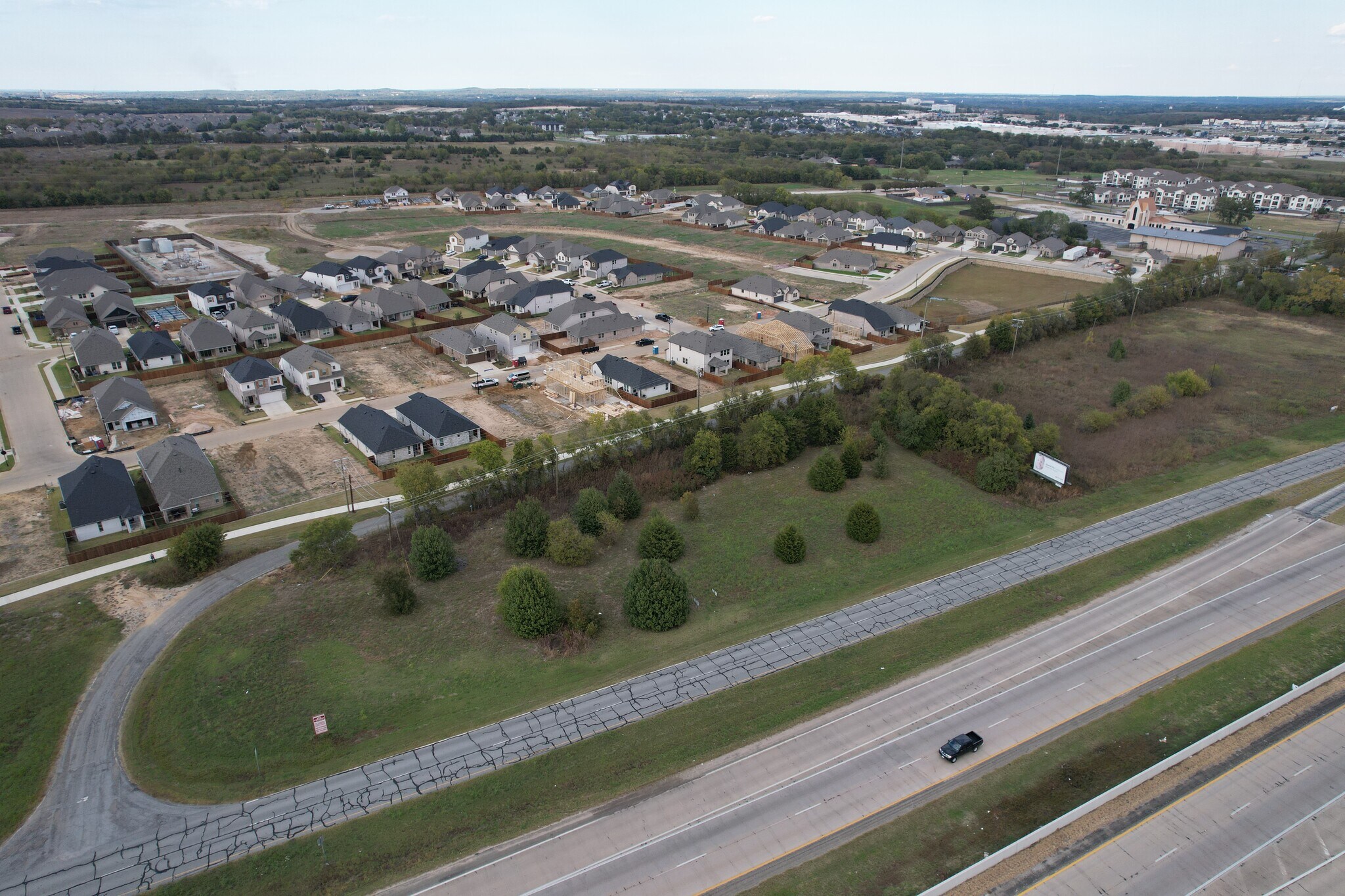
400 W US Hwy 82 1.63 Acres of Commercial Land Offered at $2,053,095 CAD in Sherman, TX 75092
Investment Highlights
- Easy Access to W US Hwy 82
Executive Summary
Bullseye Location (overlay district)
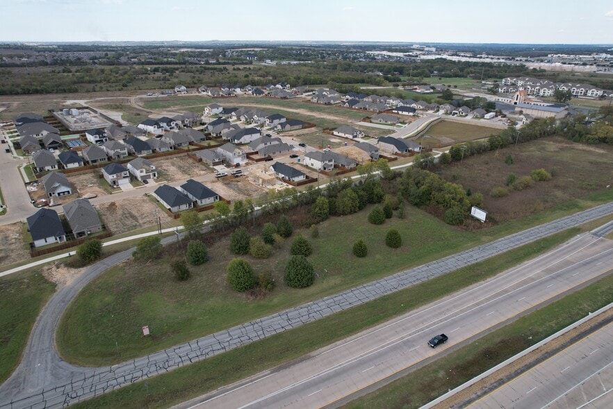
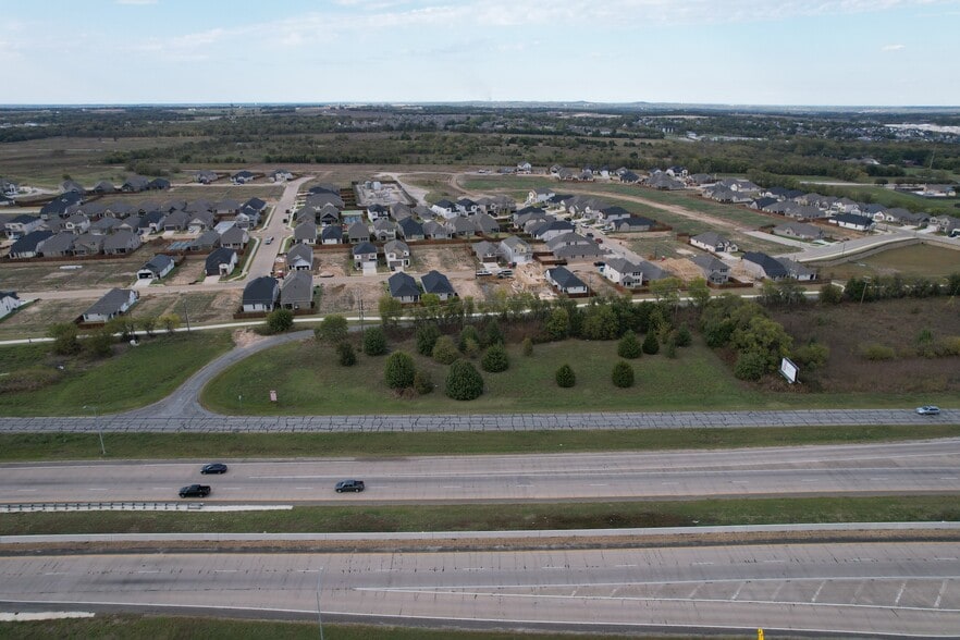
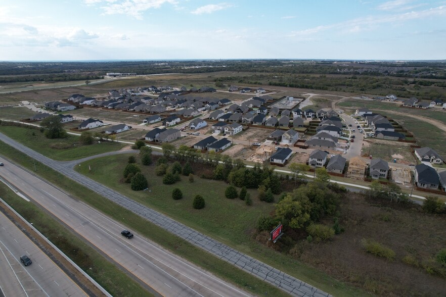
1.63 acres (71,003 sq. ft.) Sherman, Texas, westbound Hwy 82, 0.5 miles west of the intersection of Hwy 82 and U.S. Hwy 75. Two-way W. Canyon Grove Rd is on the northern boundary of the property and lies between two major subdivisions, (at present, under construction)
1.63 acres (71,003 sq. ft.) Sherman, Texas, westbound Hwy 82, 0.5 miles west of the intersection of Hwy 82 and U.S. Hwy 75. Two-way W. Canyon Grove Rd is on the northern boundary of the property and lies between two major subdivisions, (at present, under construction)
Property Facts
| Price | $2,053,095 CAD | Property Subtype | Commercial |
| Sale Type | Investment | Proposed Use | |
| No. Lots | 1 | Total Lot Size | 1.63 AC |
| Property Type | Land | Opportunity Zone |
Yes
|
| Zoning | D1 - Commercial AG | ||
| Price | $2,053,095 CAD |
| Sale Type | Investment |
| No. Lots | 1 |
| Property Type | Land |
| Property Subtype | Commercial |
| Proposed Use | |
| Total Lot Size | 1.63 AC |
| Opportunity Zone |
Yes |
| Zoning | D1 - Commercial AG |
1 Lot Available
Lot
| Price | $2,053,095 CAD | Lot Size | 1.63 AC |
| Price Per AC | $1,259,564.35 CAD |
| Price | $2,053,095 CAD |
| Price Per AC | $1,259,564.35 CAD |
| Lot Size | 1.63 AC |
1.63 acres (71,003 sq. ft.) Sherman, Texas, westbound Hwy 82, 0.5 miles west of the intersection of Hwy 82 and U.S. Hwy 75. Two-way W. Canyon Grove Rd is on the northern boundary of the property and lies between two major subdivisions.
Description
1.63 acres located westbound Hwy 82, 0.5 miles west of the intersection of Hwy 82 and U.S. Hwy 75. Two-way W. Canyon Grove Rd is on the northern boundary of the property and lies between two major subdivisions, (at present, under construction).


Property Taxes
| Parcel Number | 121088 | Improvements Assessment | $0 CAD |
| Land Assessment | $3,575 CAD | Total Assessment | $3,575 CAD |
Property Taxes
Parcel Number
121088
Land Assessment
$3,575 CAD
Improvements Assessment
$0 CAD
Total Assessment
$3,575 CAD
1 of 18
Videos
Matterport 3D Exterior
Matterport 3D Tour
Photos
Street View
Street
Map
Presented by
400 W US Hwy 82
Already a member? Log In
Hmm, there seems to have been an error sending your message. Please try again.
Thanks! Your message was sent.