Log In/Sign Up
Your email has been sent.

630 Youngstown Warren Rd - Reduced Land! 5.1 Acres of Commercial Land Offered at $591,614 CAD in Niles, OH 44446

Investment Highlights
- 5.1 acres
- 162' frontage
- High traffic counts
- 2.3 Miles | Less than 4 minutes to St. Rt 11.
Executive Summary
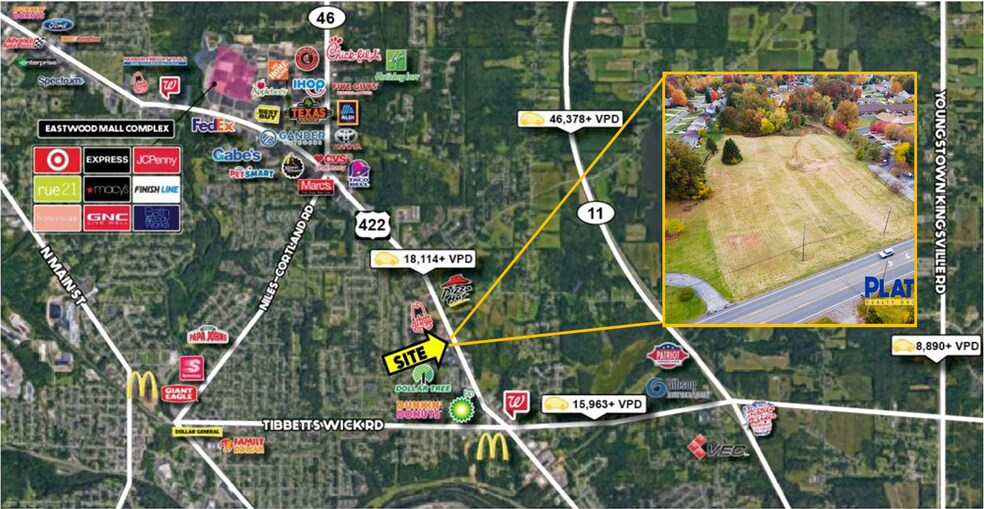
High exposure on ST RT 422 by SR 46
Property Facts
| Price | $591,614 CAD | Property Subtype | Commercial |
| Sale Type | Owner User | Proposed Use | |
| No. Lots | 1 | Total Lot Size | 5.10 AC |
| Property Type | Land | ||
| Zoning | B3, RA, & Commercial | ||
| Price | $591,614 CAD |
| Sale Type | Owner User |
| No. Lots | 1 |
| Property Type | Land |
| Property Subtype | Commercial |
| Proposed Use | |
| Total Lot Size | 5.10 AC |
| Zoning | B3, RA, & Commercial |
1 Lot Available
Lot
| Price | $591,614 CAD | Lot Size | 5.10 AC |
| Price Per AC | $116,002.83 CAD |
| Price | $591,614 CAD |
| Price Per AC | $116,002.83 CAD |
| Lot Size | 5.10 AC |
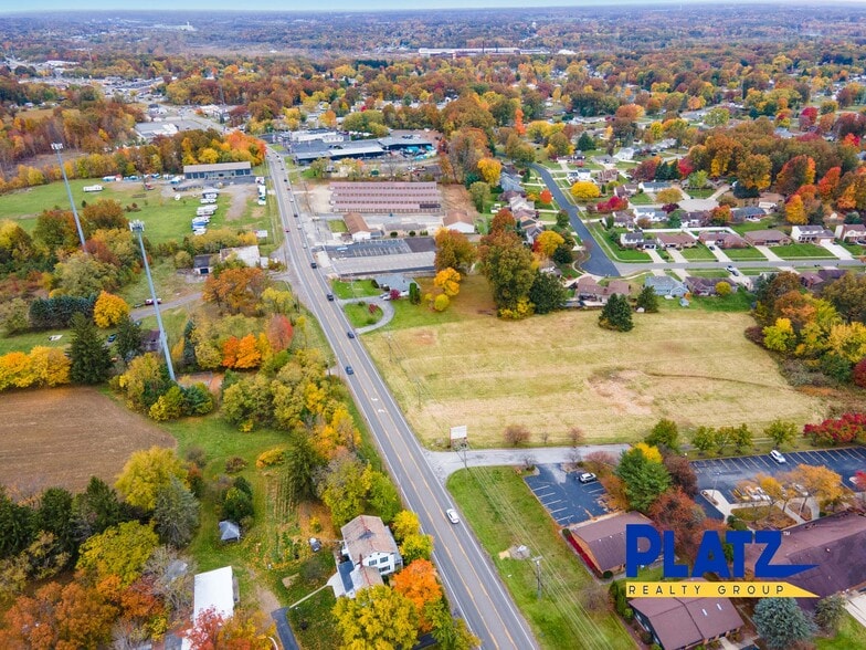
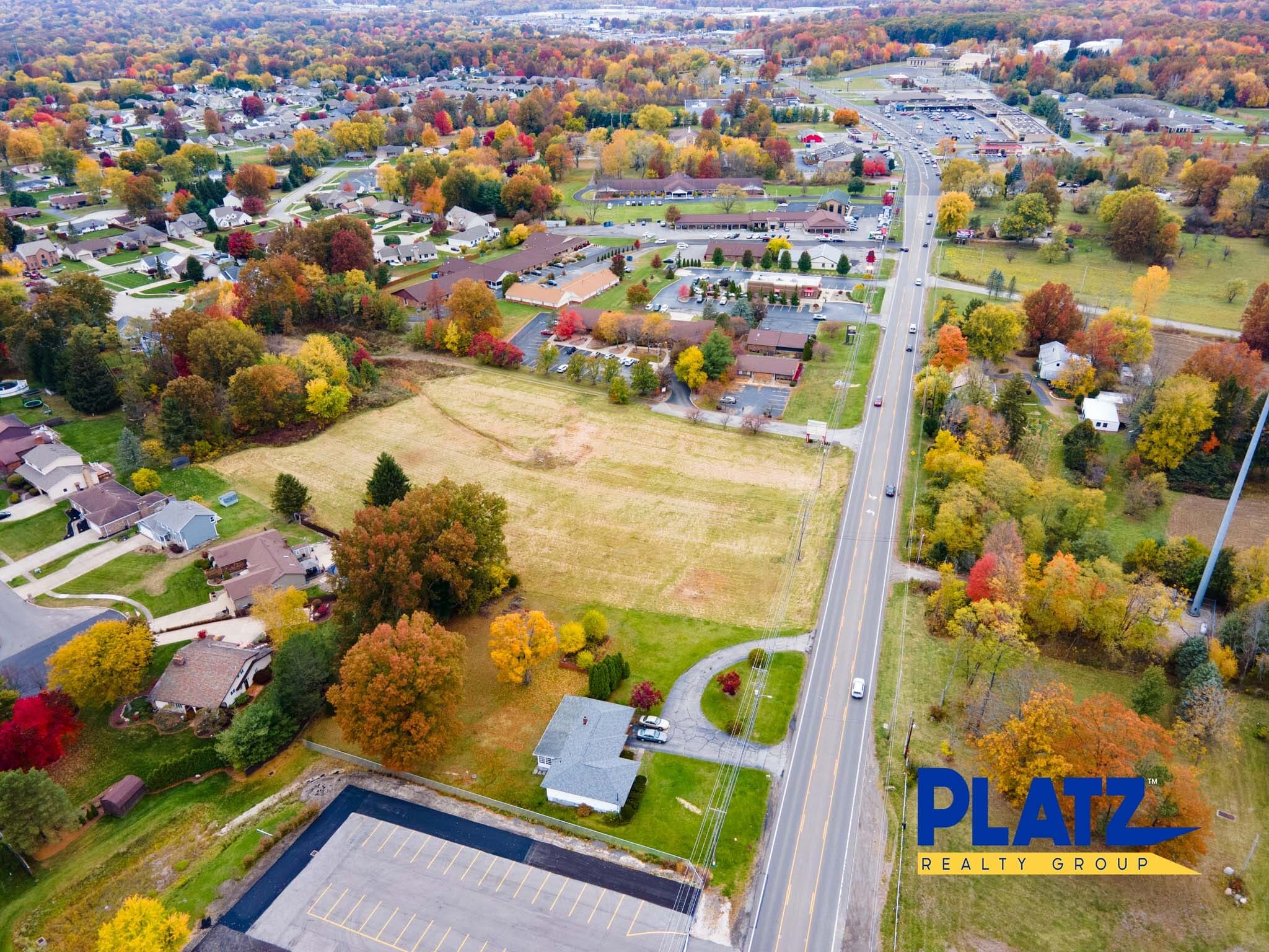
Reduced! 5.1 acres on Youngstown Warren Rd (US 422) 162’ frontage +/-; Located east of SR 46 (Niles Cortland Rd) 2.3 Miles | Less than 4 minutes to St. Rt 11 High traffic location All public utilities available
Description
5.1 acres of vacant land in Niles, OH Land located in Niles City and Weathersfield Township 162' frontage 2.3 Miles | Less than 4 minutes to St. Rt 11.
1 1
Somewhat walkable
30/100
Exceptionally drivable
100/100
Limited public transit
30/100
Somewhat bikeable
20/100
Property Taxes
| Parcel Numbers | Improvements Assessment | $0 CAD | |
| Land Assessment | $73,167 CAD | Total Assessment | $73,167 CAD |
Property Taxes
Parcel Numbers
Land Assessment
$73,167 CAD
Improvements Assessment
$0 CAD
Total Assessment
$73,167 CAD

1 of 9
Videos
Matterport 3D Exterior
Matterport 3D Tour
Photos
Street View
Street
Map
1 of 1
Presented by
630 Youngstown Warren Rd - Reduced Land!
Already a member? Log In
Hmm, there seems to have been an error sending your message. Please try again.
Thanks! Your message was sent.