Log In/Sign Up
Your email has been sent.

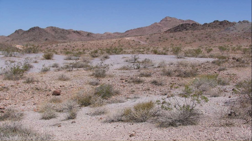
Hwy 68 - 243 acres hwy 68 243 Acres of Residential Land Offered at $1,702,288 CAD in Bullhead City, AZ 86430
Investment Highlights
- 1 Mile of frontage on Hwy 68
Executive Summary
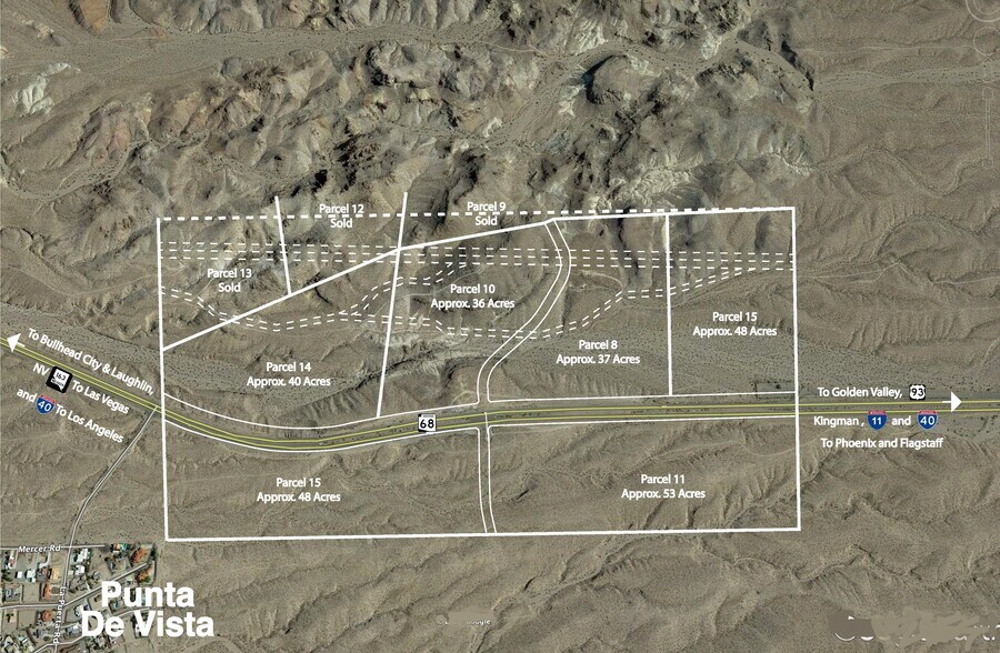
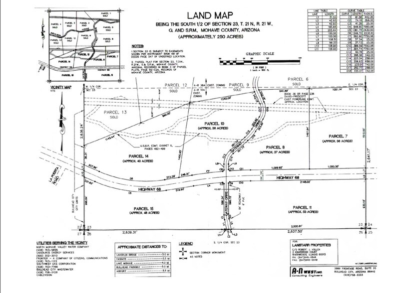
243 Acres APN's: (349-02-007A, 008A, 010A, 014A - north side of 68) and (011A & 015A - south side of 68). 2020 Taxes total for all 6 properties: $1,001.14. The 2 westernmost parcels, #14 on the north and # 15 on the south share a common boundary with the Bullhead City city limits. Property is in the Mohave Water Conservation District, an independent governmental unit which is a part of Mohave Valley Water Authority. Approximately 1 mile of Hwy 68 frontage. Seller would consider selling off parcels on south side together or north side together. (Some parcels if sold independently, would have higher values than others)
Property Facts
1 Lot Available
Lot
| Price | $1,702,288 CAD | Lot Size | 243.00 AC |
| Price Per AC | $7,005.30 CAD |
| Price | $1,702,288 CAD |
| Price Per AC | $7,005.30 CAD |
| Lot Size | 243.00 AC |
243 Acres APN's: (349-02-007A, 008A, 010A, 014A - north side of 68) and (011A & 015A - south side of 68). The 2 westernmost parcels, #14 on the north and # 15 on the south share a common boundary with Bullhead City, AZ.

Exceptionally drivable
100/100
Not bikeable
10/100
Property Taxes
| Parcel Numbers | Improvements Assessment | $0 CAD | |
| Land Assessment | $847,594 CAD | Total Assessment | $847,594 CAD |
Property Taxes
Parcel Numbers
Land Assessment
$847,594 CAD
Improvements Assessment
$0 CAD
Total Assessment
$847,594 CAD

1 of 13
Videos
Matterport 3D Exterior
Matterport 3D Tour
Photos
Street View
Street
Map

Presented by
Hwy 68 - 243 acres hwy 68
Already a member? Log In
Hmm, there seems to have been an error sending your message. Please try again.
Thanks! Your message was sent.