Log In/Sign Up
Your email has been sent.

Maulding Ave - 2.27 +/- Acres Residential Land 2.27 Acres of Residential Land Offered at $892,918 CAD in Las Vegas, NV 89123
Investment Highlights
- $174,008 per acre/$3.99 per square foot
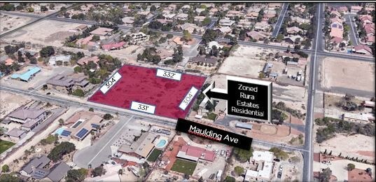
- Clark County Zoned (RE) Rural Estates Residential
- APN: 177-09-602-007
- Planned Land Use (RNP) Rural Neighborhood Preservation
Executive Summary
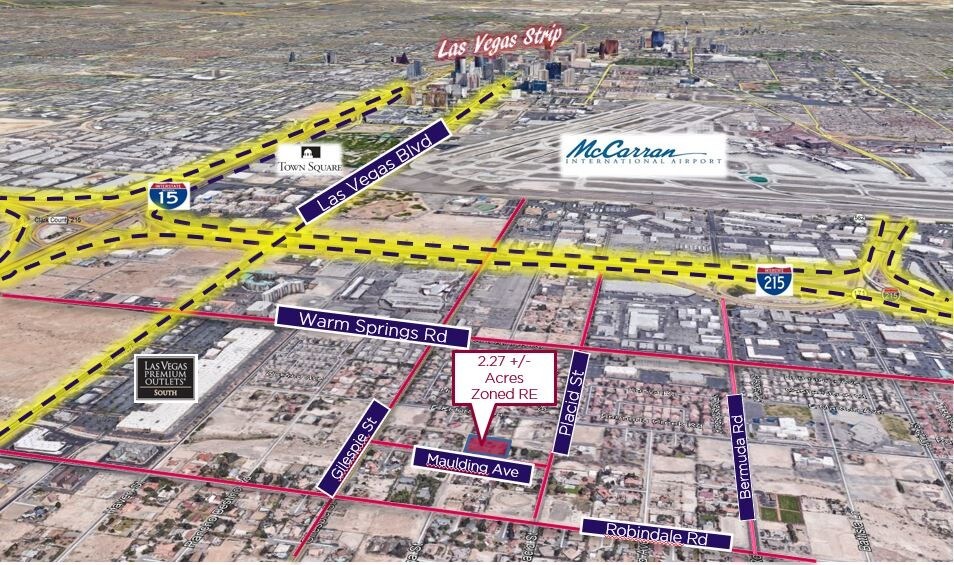
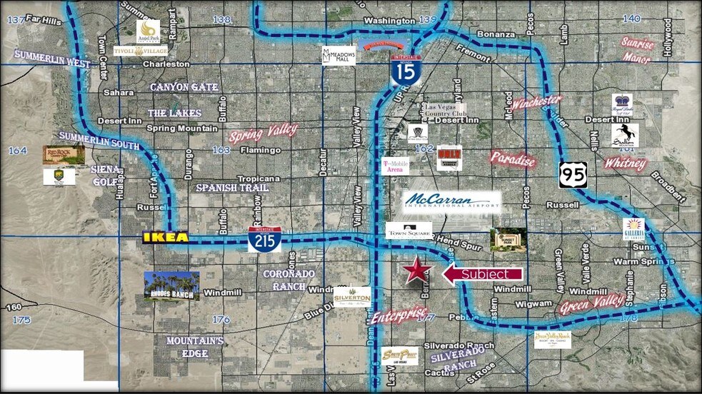
Residential Vacant Land East of Las Vegas Blvd and North of Robindale Rd. Close to the "Strip", I15, and 215 Beltway.
Seller requests First American Title Company
APN: 177-09-602-007
Unincorporated area-Clark County Enterprise District.
Zoned R-E- Rural Estates Residential (2 units per acre) with planned land use of RNP-Rural Neighborhood Preservation. This provides for single-family homes on large lots, including equestrian facilities.
Only 2 miles from McCarran Airport and 1 mile from Las Vegas Outlet Mall
Property Facts
| Price | $892,918 CAD | Property Subtype | Residential |
| Sale Type | Owner User | Proposed Use | Single Family Development |
| No. Lots | 1 | Total Lot Size | 2.27 AC |
| Property Type | Land | ||
| Zoning | R-E | ||
| Price | $892,918 CAD |
| Sale Type | Owner User |
| No. Lots | 1 |
| Property Type | Land |
| Property Subtype | Residential |
| Proposed Use | Single Family Development |
| Total Lot Size | 2.27 AC |
| Zoning | R-E |
1 Lot Available
Lot awbrufy
| Price | $892,918 CAD | Lot Size | 2.27 AC |
| Price Per AC | $393,355.96 CAD |
| Price | $892,918 CAD |
| Price Per AC | $393,355.96 CAD |
| Lot Size | 2.27 AC |
2.27+/- Acres Vacant Residential Land
Description
Exclusive Listing!!! $174,008 per acre/$3.99 per square foot APN: 177-09-602-007 2018 Taxes $1,063.63 Clark County Zoned (RE) Rural Estates Residential Planned Land Use (RNP) Rural Neighborhood Preservation Parcel is in a 100-year flood zone. Type: Zone AE
1 1
Fairly walkable
40/100
Exceptionally drivable
90/100
Limited public transit
30/100
Fairly bikeable
40/100
Property Taxes
| Parcel Number | 177-09-602-007 | Improvements Assessment | $0 CAD |
| Land Assessment | $210,351 CAD | Total Assessment | $210,351 CAD |
Property Taxes
Parcel Number
177-09-602-007
Land Assessment
$210,351 CAD
Improvements Assessment
$0 CAD
Total Assessment
$210,351 CAD

1 of 7
Videos
Matterport 3D Exterior
Matterport 3D Tour
Photos
Street View
Street
Map

1 of 1
Presented by
Maulding Ave - 2.27 +/- Acres Residential Land
Already a member? Log In
Hmm, there seems to have been an error sending your message. Please try again.
Thanks! Your message was sent.