Se Connecter/S’inscrire
Votre courriel a été envoyé.
133 Newmans Ln - Mile Marker 12 Lot • Terrain commercial • 58,41 Acres • Buras, LA 70041
Certaines informations ont été traduites automatiquement.
Faits saillants de l'investissement
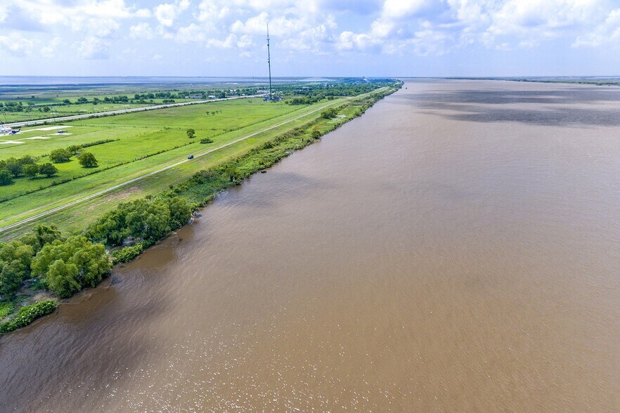
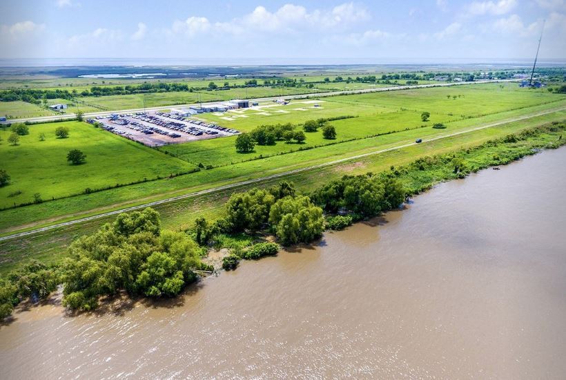
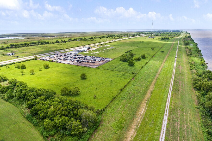
- Located along the Mississippi River
Résumé de l'annonce
This offering, ideally located at Mile Marker 12, provides a strategic and proximate location for land-based operations to gulf, ocean, and any deep-water waterborne traffic. The tract possesses significant frontages along the West Bank of the Mississippi River, substantive support land areas, frontage along Highway 23 and a Heavy Industrial Zoning designation. The property previously received an Army Corps of Engineers Permit in 2005 for development of a ship-to-barge transfer facility. The property features .57 miles (3,019’) linear frontage along the west bank of the Mississippi River with +/- 54 usable acres of land that can accommodate numerous industrial uses including—Tank Farm-Terminal Operations, Single-Point Mooring Operations, Docking, etc.. I-3, Heavy Industrial (Plaquemines Parish) Zoned for Heavy Industrial Development
Faits sur la propriété
| Type de vente | Investissement | Sous-type de propriété | Terrain commercial |
| Nombre de lots | 1 | Utilisation proposée | Commercial |
| Type de propriété | Terrain | Taille totale du lot | 58,41 AC |
| Zonage | I-3 | ||
| Type de vente | Investissement |
| Nombre de lots | 1 |
| Type de propriété | Terrain |
| Sous-type de propriété | Terrain commercial |
| Utilisation proposée | Commercial |
| Taille totale du lot | 58,41 AC |
| Zonage | I-3 |
1 Lot disponible
Lot
| Taille du lot | 58,41 AC |
| Taille du lot | 58,41 AC |
45’ at approximately 125’ from the Shore and 65’ at 375’ from Shore
Description
The site boasts approximately 0.57 miles (±3,019 linear feet) of Mississippi River frontage, along with frontage along Highway 23, providing both waterborne and land-based access. Water depths in the adjacent river channel are reported at approximately 45 feet within 125 feet of shore and up to 65 feet at 375 feet from shore, supporting large-vessel and barge traffic.

Impraticable à pied
10/100
Exceptionnellement facile d’accès en voiture
100/100
Assez praticable en vélo
20/100
Impôts fonciers
| Numéro de lot | 1616169 | Évaluation des bâtiments | 5 294 $ CAD |
| Évaluation du terrain | 2 761 $ CAD | Évaluation totale | 8 055 $ CAD |
Impôts fonciers
Numéro de lot
1616169
Évaluation du terrain
2 761 $ CAD
Évaluation des bâtiments
5 294 $ CAD
Évaluation totale
8 055 $ CAD

1 de 20
Vidéos
Visite extérieure 3D Matterport
Visite 3D Matterport
Photos
Vue depuis la rue
Rue
Carte

Présenté par

133 Newmans Ln - Mile Marker 12
Vous êtes déjà membre? Connectez-vous
Hmm, il semble y avoir eu une erreur lors de l’envoi de votre message. Veuillez réessayer.
Merci! Votre message a été envoyé.