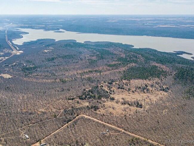
Durango Land for Sale
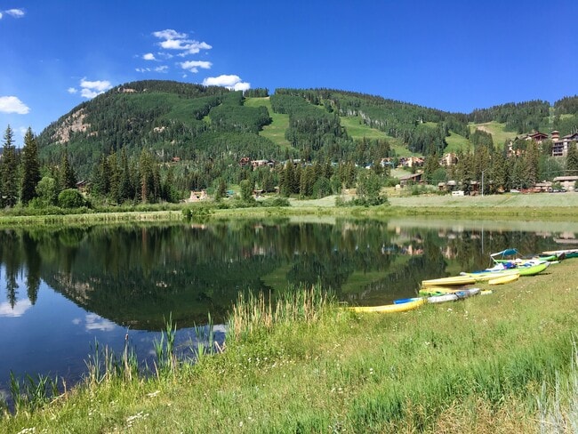
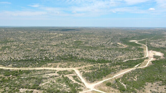
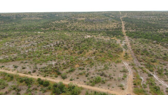
Extraordinary ski resort development opportunity with extensive "scenic highway" frontage, sweeping Rocky Mountain views, and utilities on-site or nearby. * Year-round visitors drawn to regional attractions like Mesa Verde, Grand Canyon, Moab, Lake Powell along with ski resort events and activities, hiking, mountain biking, etc. * La Plata County Village Conceptual Plan approval complete for 120 room hotel, 75 condo residential units and 180,000 commercial GSF. * Enjoy convenient ski shuttles, Durango Mountain Club amenities, fitness and spa facilities, outdoor heated pool and multiple spas and social calendar of events. * Commercial / mixed-use resort land use designation allows for a flexible mix of 195 hotel/lifestyle lodging or MF residential units plus 180,000 GSF of commercial, restaurant, office and more! * Building height 3 stories above parking with a maximum height of 45 feet above grade due to location along scenic highway corridor. * Prime highway frontage with CDOT access permit in process. * USACE wetland permit in place with offsite mitigation in place. * Developer/Seller available to assist with County Planning process.
Established in 1881, Durango is located in SW Colorado near the four corners where Arizona, New Mexico, Colorado and Utah come together and is home to Fort Lewis College, a four-year college; CommonSpirit/Mercy regional medical facility; La Plata County Regional Airport and a wide variety of boutiques, specialty shops, galleries and many diverse restaurants. There are three prominent historic districts: Main Avenue Historic District, East Third Avenue Historic Residential District and the Durango & Silverton Narrow Gauge Railroad right-of-way between Durango and Silverton, Colorado. Surrounded by two million acres of San Juan National Forest and situated at an elevation of 6,512 feet, Durango is the ideal blend of quality of lifestyle, commerce, outdoor adventures, history, the arts and culture. Durango population 56,823 (2024)
SITE OFFERING HIGHLIGHTS:
• First time ever offered for sale to the public by the master developer of Purgatory Ski Resort
• A Village Conceptual Plan has been approved with the La Plata County Planning Department for a 120-room hotel, 75 condo residential units and up to 180,000 commercial GSF was approved in 2024 – an incredible opportunity to develop the very first hotel at the Resort!
• Breathtaking sweeping Rocky Mountain and valley views
• Unique opportunity to develop the very first hotel at Purgatory Ski Resort!
• As the Resort has been experiencing a high volume of development and expansion in recent years, there is an opportunity to share some expenses with other site developers nearby for extending utilities to serve this site.
• The site is set along the picturesque “San Juan Skyway Scenic Byway”, a 236-mile loop including Durango, Silverton, Ouray and Telluride and the Million Dollar Highway. It is designated as an All-American Road for its outstanding scenic, geologic, and historic sites and features historic mining towns, ancient ruins, and high mountain passes.
ABOUT PURGATORY SKI RESORT Established in 1965 and celebrating 60 years this year! There are 107 named ski trails (51 miles), 11 lifts including a high-speed 6-pack, 1,635 skiable acres of terrain, 2,029 feet of vertical drop and 4 terrain parks. As a part of the Durango Mountain Master Association, this property will have access to a wide variety of Resort amenities including an exclusive restaurant in the Durango Mountain Club complete with a full bar, oversized stone fireplace and incredible views; a game room with video games, board games, billiards and TVs; state-of-the-art fitness center with spa treatment rooms; ski valet; restrooms and showers; heated outdoor swimming pool with slide and surrounded by heated pavers; multiple outdoor hot tubs; and access to the Club side of the Bear Bar serving a light menu with full bar.
During the summer, the Resort offers outdoor activities to everyone including the Alpine Slide, Mountain Coaster, Scenic Chairlift Ride, Treasure Panning, Twilight Lake fishing and kayaking, Mountain Biking Trails and UTV/RZR/Jeep Rentals and Tours. Winter season activities include Snowcat Skiing, Snowcat Dining Excursions, Scenic Snowcat Tours, Snowmobile Adventures, Mountain Coaster, Tubing Hill and Snowshoe Tours.
Purgatory Ski Resort hosts a wide variety of events, live music, mountain biking and skiing competitions, etc. year-round.
ABOUT DURANGO
Established in 1881, Durango is located in SW Colorado near the four corners where Arizona, New Mexico, Colorado and Utah come together and is home to Fort Lewis College, a four-year college; CommonSpirit/Mercy regional medical facility; La Plata County Regional Airport and a wide variety of boutiques, specialty shops, galleries and many diverse restaurants. There are three prominent historic districts: Main Avenue Historic District, East Third Avenue Historic Residential District and the Durango & Silverton Narrow Gauge Railroad right-of-way between Durango and Silverton, Colorado. Surrounded by two million acres of San Juan National Forest and situated at an elevation of 6,512 feet, Durango is the ideal blend of quality of lifestyle, commerce, outdoor adventures, history, the arts and culture. Durango population: 56,823 (2024)
REGIONAL TOURISM ATTRACTIONS:
Mesa Verde National Park
Arches & Canyonlands National Parks
Lake Powell at the Glen Canyon National Recreation Area
Black Canyon of the Gunnison National Park
Monument Valley Navajo Tribal Park
Canyon de Chelly
Antelope Canyon & Horseshoe Bend
Pagosa Hot Springs
Wolf Creek Ski Area
Grand Canyon National Park
THINGS TO DO IN /AROUND DURANGO:
Durango Hot Springs
Animas River Rafting
Horseback Riding
Jeeping through the San Juans
Fly Fishing
Mountain Biking
Ride the Durango Silverton Narrow Gauge Railroad
Soaring Tree Top Adventures
Gallery Walk
Tour Old Gold Mines
Lake Nighthorse
Vallecito Lake
Navajo Lake
Canyons of the Ancients
Ute Mountain Casino Hotel
DISTANCE FROM PURGATORY RESORT TO MAJOR CITIES:
Grand Junction, CO – 145
Moab, UT - 183
Albuquerque, NM – 240
Santa Fe, NM – 241
Denver, CO - 365
Salt Lake City, UT – 388
Phoenix/Scottsdale, AZ - 486
LA PLATA COUNTY REGIONAL AIRPORT: www.flydurango.com
2000 – 182,256 Total Passengers
2024 – 499,110 Total Passengers
Served by United & American Airlines
Our regional La Plata County Airport has a major expansion and remodel underway! Check www.flydurango.com for plans and details.